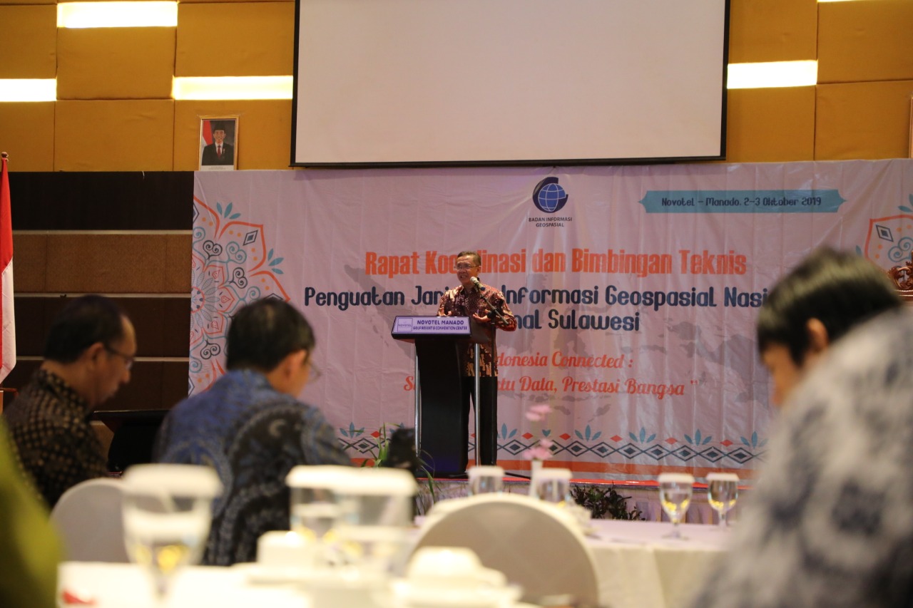
Manado, Geopasial News - To end the series of activities of the Coordination Meeting and Coordination of Technical Assistance (Bimtek) for Strengthening the National Geospatial Information Network in 2019, the Geospatial Information Agency on Wednesday, October 2, 2019, held a Coordination Meeting and Technical Guidance for Strengthening the JIGN Region in Sulawesi and Maluku in 2019. Manado North Sulawesi Province. At the Grand Kawanua Hotel Novotel Manado North Sulawesi Ballroom, this coordination meeting and technical guidance were the closing events of the same series of events for 2019.
The theme of the JIGN Rakor and Bimtek Strengthening event this time was "Indonesia Connected: One Map, One Data, Nation's Achievement". Around 240 participants came from various backgrounds in the North Sulawesi Province and several representatives from Regencies / Cities in North Sulawesi, Maluku and North Maluku Provinces and Sam Ratulangi University. In this coordination meeting and bimtek also the signing of the Memorandum of Understanding between BIG and the North Sulawesi Provincial Government and the Cooperation Agreement between BIG and the North Sulawesi Provincial Health Office.
Present at the event which started from the morning were BIG Head, Hasanuddin Zainal Abidin; Deputy Governor of North Sulawesi, Drs. Steven O.E. Kandow; Mayor of Manado, Dr. GS Vicky Lumentut; Deputy Rector IV of Sam Ratulangi University, Prof. Dr. Ir. Sangkertadi, DEA; Deputy Commander of XIII / Merdeka, Lieutenant Colonel CTP Teddy Karwur; and Senior Officials at BIG and North Sulawesi Provincial Government.

Opening the coordination meeting and technical assistance for the strengthening of JIGN, Head of the Center for Geospatial Information Dissemination, Dr. Ing. Khafid, said that BIG as the geospatial data builder hoped that the participants who organized geospatial information (IG) in the regions could be able to hold the IG in a sustainable manner. "We have come to say that JIGN is currently connected with a new policy on one Indonesian data, and for this, it is necessary to strengthen JIGN at the district and provincial levels. JIGN, which should have involved all cities/regencies and K / Ls throughout Indonesia, turns out that currently only about 221 are connected, so it is still far from being expected to be connected as a whole. And it is hoped that by holding a coordination meeting and technical guidance the strengthening of JIGN this time can make North Sulawesi Province a good example for other regions, "Khafid said.
For information, in 2019, BIG has carried out five coordination meetings and technical assistance for strengthening JIGN in all regions in Indonesia. The first coordination meeting and bimtek were held in Riau Province, for the Sumatra Region, the second was held in Manokwari, for the Papua Region, the third was held in Surabaya, for the Java, Bali and Nusra Region, the fourth in Pontianak, for the Kalimantan Region, and finally in Manado, for the Sulawesi and Papua regions.
Data and IG especially for development planning are built with 5 pillars, the first pillar related to legislation at the national and regional levels, the two Institutions, it is unclear exactly where previously established must be moved, the three human resources, important because as a development motor, fourth Technology, for sharing, data must be accessible, and the fifth is data, where the said data must meet applicable standards.
While representing the host and opening the event, the Deputy Governor of North Sulawesi, Drs. Steven O.E. Kandow, in his speech representing the Governor of North Sulawesi, said, Steven said that the problem of understanding geospatial should have become a lifestyle, but now it turns out that it is still far from the fire. In addition, there are also various problems related to regional borders, such as those from the Bolaang Mongondow and Bolaang Mongondow Selatan regions. Another problem is that HR is in charge of geospatial information, it is necessary to continuously improve its capabilities.
As a sign of the opening of the Rakor and Bimtek Strengthening of the Sulawesi and Maluku Region JIGN Region, the Deputy Governor of North Sulawesi Province accompanied by the Head of BIG, symbolically opened the event by beating a gong on stage. The event then continued with souvenir exchanges between institutions and ended with a group photoactivity.
The program then continued with the signing of a memorandum of understanding between BIG and the North Sulawesi Provincial Government, and the cooperation agreement between BIG and the North Sulawesi Provincial Health Office and the submission of the One Map Policy Geoportal account from BIG's Head to the North Sulawesi Deputy Governor. [DA / TR]
