Geospatial News, Jakarta - Until now, the availability of large-scale base maps throughout Indonesia has only reached 1.7% of the total area of Indonesia. This is considered to hamper some national programs such as the preparation of detailed spatial plans (RDTR). Of the 1838 RDTRs that were supposed to be compiled, only 55 RDTRs or 2.8% had been completed into local regulations.
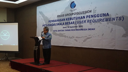
This was revealed by Deputy Geospatial Information Division Geospatial Information Agency (BIG) Mohammad Arief Syafi'I at the Focus Group Discussion (FGD) Discussion on the Needs of Users of Large Scale Base Maps in Jakarta, 30 September 2019.
"With its current capacity, it will take at least 150 years to complete a large-scale base map that wiped out all regions of Indonesia," Arief said.
For this reason, an accelerated effort is needed to resolve the issue. BIG is targeting that in the next 5 years a 1: 5,000 scale map will be available which covers all regions of Indonesia. FGDs were held to explore the needs of basic map users from ministries, agencies and local governments. From there a large-scale mapping acceleration plan will be drawn up.

"We want to know, if not all, which ones are priorities. Regarding this base map, not all agencies need 8 elements, we want to identify the user's needs related to the base map. So that we can prioritize which ones are resolved first, "explained Arief.
During this time, large-scale maps are only available in certain areas, such as in big cities, special economic zones, and industrial zones. In the preparation of RDTR, the regional government finally used high-resolution satellite imagery. But this has not been able to meet the technical needs of mapping.
"We have to think out of the box. Cannot use the usual method. If it cannot be accelerated, like it or not, we have to wait patiently for 150 years, "concluded Arief. (MAD)
