Geospatial News - "It is better to prevent than to cure", maybe this proverb is very appropriate in conditioning disaster management of forest and land fires (Karhutla) that occur in Indonesia. In disaster management, there is a paradigm shift from being responsive to being preventive, or from managing impacts to reducing risk. This causes a larger and more important portion of pre-disaster activities. One of the most important pre-disaster activities is a contingency plan or a standby plan. Contingency plans are prepared before a disaster occurs and implemented when a disaster will or will occur.
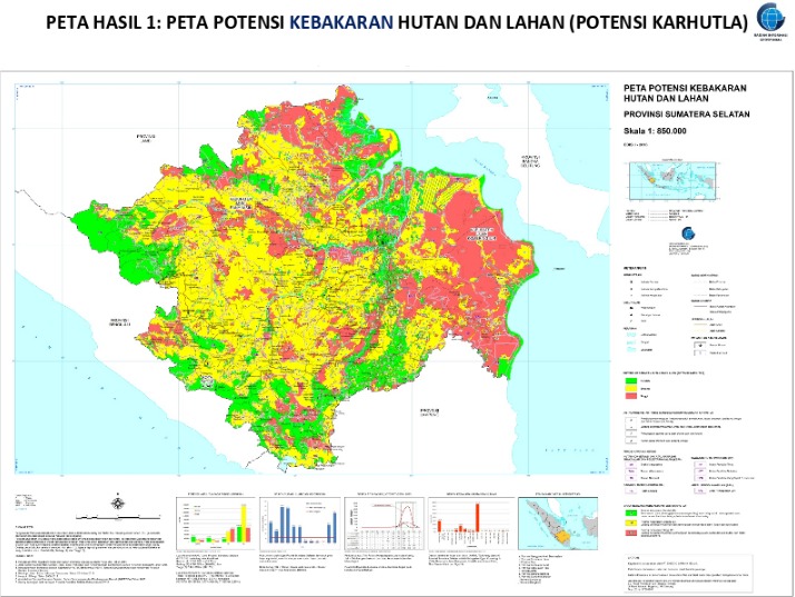
Back to the prevention of forest and land fires, appropriate actions in controlling forest and land fires are not merely talking about effective fire fighting, but strengthening prevention which is an action in the pre-disaster phase. One reinforcement of prevention is to identify areas prone to forest and land fires by mapping existing conditions related to physical and non-physical potentials that can cause fires in an area so that preparedness can be strengthened in anticipation of forest and land fire prevention.
Mapping of forest and land fire is emphasized to identify the factors causing forest and land fire vulnerability. Besides being caused by climate factors, forest and land fires can be caused by human factors. More than 90% of the causes of forest and land fires in Indonesia are due to human (anthropogenic) interference factors, both intentional and unintentional. Economic motives for profit are the main cause of forest and land fires. Some things that cause fire by humans are: burning for land preparation activities because it is easier and cheaper, the spread of fire that is unintentional or uncontrolled, and the use of fire in social / land conflicts. Mapping physical potential such as land cover, hotspots. altitude, weather and non-physical factors such as community behavior, location of land allotment permits, and socio-cultural conditions of the region are important indicators to be mapped in knowing the existing conditions and their effects on forest and land fire vulnerability.

At present BIG and KLHK have prepared mapping standards in identifying the potential of an area prone to forest and land fires. Even though the guidelines for mapping forest and forest prone areas have been carried out by many stakeholders and agencies related to forest and land fire mitigation, but until now there has been no national standard guidelines agreed by all parties. On the other hand, map accuracy is increasingly demanded to make the map operational effectively in the field at both the prevention and forestry mitigation stages. Prevention activities carried out by various agencies and community groups must be supported by adequate, effective and efficient facilities and infrastructure. Map of forest and forest fire is a guideline for various activities such as patrol guidelines, placement of forest and forest fire control posts, monitoring preparedness, and contingency planning.
In addition, the exploration of cooperation in fulfilling maps of forest and forest fire has been initiated by BIG and KLHK. Cooperation is directed in implementing the Standardization of Mapping of the Forestry and Hazardous Areas as outlined in the program of providing thematic maps to support forestry mitigation, the preparation of maps of forestry-prone areas and enhancing the capacity of Human Resources (HR) in the framework of providing forestry-prone maps in the regions. Provision of maps can be prioritized for areas that often experience forest and land fires in large areas such as Sumatra, Kalimantan, and Nusa Tenggara. (* the points of the agreement contained in the cooperation agreement have reached the final stage, if there is no obstacle in the end of September 2019 will be signed by both parties).
The more coordinating cooperation between ministries/institutions involved in strengthening the forestry disaster management program will be more effective in preventing forest and land fire. The forest and land fires cannot be resolved by just one party, one of the keys to success in overcoming them is massive cooperation and intensive coordination between government, private and community for the strengthening of disaster management. (FP)
