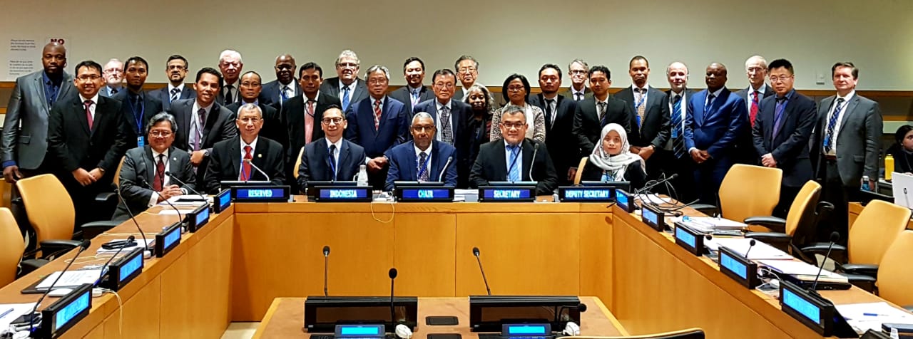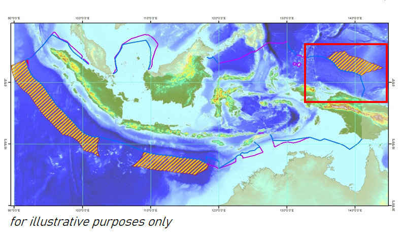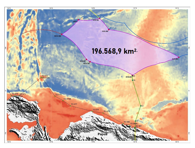
Joining the Indonesian Continental Shelf Team, the Geospatial Information Agency was represented by Deputy for Basic Geospatial Information Mohamad Arief Syafi'i, and the team was present at the submission of the Indonesian continental shelf outside 200 nautical miles north of Papua. The submission was presented to the United Nations Commission on the Limit of the Continental Shelf (CLCS) at the United Nations headquarters, New York, on March 4, 2020.
Following international sea law (United Nations Convention on the Law of the Sea / UNCOS 1982), coastal countries, including Indonesia, have the right to determine the outer boundaries of continental shelf exceeds 200 nautical miles if they are not bordered by other countries. This must be scientifically proven and approved by UN-CLCS.
The area of approximately 196,568.9 square kilometers currently overlaps with submissions from several neighboring countries: Palau, Papua New Guinea, and the Micronesian Federation. If Indonesian's submission approved, neighbor nations would sit together to determine the boundaries of the area, which larger than the island of Sulawesi.
The next target, the Indonesian Continental Shelf Team, will deliver the submission of the western segment of Sumatra Island. Based on a study, Indonesia has the opportunity to claim an additional continental shelf area of approximately 200,000 square kilometers. Broader than the northern Papua submission segment and has no overlapping with other countries.
Based on research, the deep seabed on the continental shelf holds vast potential mineral reserves, which can even exceed the mineral reserves on land.
For the record, the Indonesian Continental Landing Team is a cross-ministerial team formed since 2018 by the Coordinating Minister for Maritime Affairs. The group consisted of representatives from the Coordinating Ministry for Maritime Affairs and Investment, the Ministry of Foreign Affairs, the Ministry of Energy and Mineral Resources, the Ministry of Transportation, the Ministry of Maritime Affairs and Fisheries, the Geospatial Information Agency, the Indonesian Institute of Sciences, the Agency for Research and Development of Technology, and the Pushidros TNI AL (MAD/RKI)


