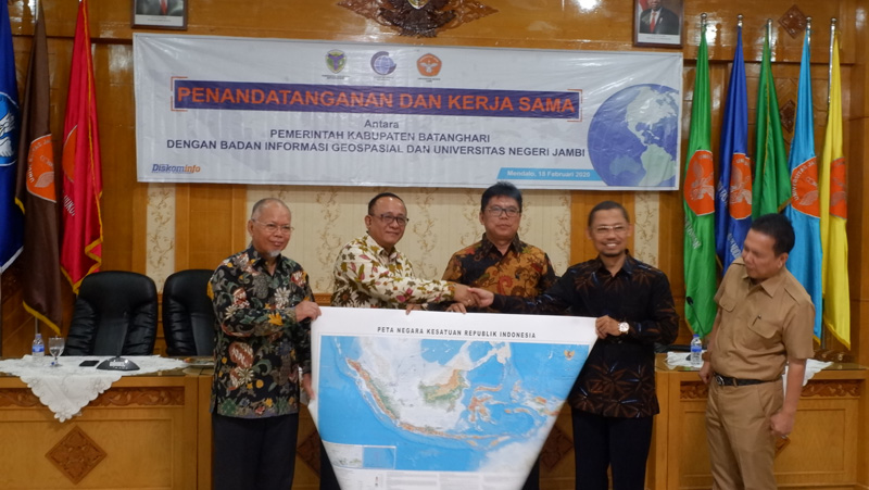
Jambi, Geospatial News - Geospatial Information Agency (BIG) cooperates with the Batanghari Regency Government. The signing of the cooperation document was held on Tuesday (18/2) in the Senate Room of the University of Jambi. The event was attended by Batanghari Regent Syahirsah, Acting Head of the BIG Sumarsono Research, Promotion and Collaboration Center, Rector of Jambi Sutrisno University, Dean of the Faculty of Engineering M. Naswir, and Assistant 1 of Regional Secretary of Jambi Province, Pani Saharudin.
In his remarks, the Regent of Batanghari said he welcomed the signing of the cooperation document between BIG-Batanghari Regency as a sign of seriousness in organizing the development of geospatial data and information in Batanghari Regency. Also, the cooperation answers the need for geospatial information that can be accounted for.
"Good development planning is produced through the process of compiling and analyzing data and accurate information, one of which is geospatial information," Syahirsyah explained.
In line with Syahirsyah, Acting Head of PPKS Center Sumaryono said that the integration of geospatial data and information is a strategic issue to realize a quality national development journey. Therefore in the future, Indonesia will not only need to continue implementing the One Map Policy but also start working on implementing the One Data Policy. Both of those require good cross-agency coordination.
"With this collaboration, it is hoped that all DPOs and local governments in Indonesia will realize that there is no development and planning without a spatial database. hope in the future Indonesia has a good spatial database to reach the regions, because the king of data is spatial, "Sumaryono explained.
In addition to the signing of the cooperation document, BIG conducts public lectures. Besides Sumaryono, Intermediate Surveyor Annacletus Ari Dartoyo filled the event with a presentation on the Strategic Development of Geospatial Information Institutions and Indonesian Data One in the Regions. The public lecture was attended by the Batanghari District OPD and Jambi University students, closed with a discussion on geospatial information and its use. (MS / MAD)
