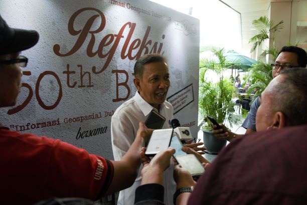
Cibinong, Geospatial Information - This year has been a memorable year for the Geospatial Information Agency (BIG). Many achievements should be celebrated as well as contemplation as a material for correction at the age of entering half a century.
One achievement to be proud of is the One Map Policy (KSP). "Our achievement in the implementation of KSP is merely to support the country's development process," said NIG Chief Hasanuddin Zainal Abidin during the '50 Years of Geospatial Information Agency Reflection 'with the theme of Geospatial Information in the Past, Present, and Later in Kuningan Epicentrum, South Jakarta, Wednesday, 18 September 2019.
This man, who is familiarly called Hasan, hopes that BIG can immediately complete a large-scale mapping to complete the KSP data. Therefore, good decisions can be produced if supported by good data as well.
"Detailed Spatial Planning (RDTL), infrastructure, smart city, agrarian reform, it needs a large scale map. Moreover, at this time the government has also prepared One Data Indonesia," Hasan said.

Hasan said, his party collaborated with the Central Statistics Agency (BPS) and the National Development Planning Agency (Bappenas) in completing KSP, in addition to all ministries/institutions (K / L) as data trustees. All available data can be utilized by all parties through the Indonesian National Geospatial Network (JIGN).
"I target all regencies in cities to be connected. Because users (geospatial maps) are mostly in regencies. Problems are there because they have to be in the forefront of access," Hasan said.
The former Professor of the Bandung Institute of Technology (ITB) realized he needed time to synchronize the KSP. He said he was constrained by the number of overlapping maps, especially regarding spatial planning.
"Cases of overlapping spatial planning have many legal, economic and social problems. There are overlapping regulations that were issued and made by the Coordinating Ministry for Economic Affairs," Hasan explained.
For information, the '50 Years of Geospatial Information Agency Reflection 'was attended by a number of former BIG Heads, Esri Indonesia CEO Achmad Istamar, Head of the Hydrographic and Oceanographic Center (Kapushirdrosal) TNI Rear Admiral Harjo Susmoro, WRI Indonesia Director Nirarta Samadhi, and other invitees. (FL / NIN)
