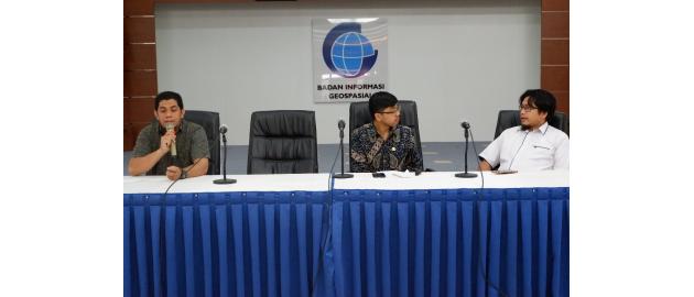
Cibinong, Geospatial News - A total of 87 Jakarta EMIISc high school students visited the Geospatial Information Agency (BIG) on Wednesday, February 6, 2019. They wanted to find out about job opportunities and the ins and outs of the geospatial field.
"Our aim here is for students to understand Geospatial Information (IG) better. Maybe later our children can have job opportunities in the geospatial field, "said the head of the EMIISc Jakarta High School, Lalu Julkarnain in his address at the BIG Hall, Cibinong, Bogor.
Then hope, students can take many lessons during the visit to BIG. This expectation is welcomed by BIG, especially the need for human resources (HR) in the geospatial field in Indonesia today is still very minimal.
"Maybe after the visit, there are EMIISc Jakarta high school students who are interested in earth science, please continue their education in geography or geodesy. Let's work together for the country together with IG, "said Agung Teguh Mandira from the Promotion and Cooperation Sector who represented the BIG welcome.
On the occasion, dozens of EMIISc high school students had the opportunity to get various materials related to IG. Exposure starts with the introduction of BIG.
"BIG is a government agency mandated by Law Number 4 of 2011 concerning IG as the organizer of IG in Indonesia. BIG is tasked with making a basic map as a reference for other agencies to make thematic maps as needed, "explained Adhy Rahadhyan as BIG PR.
In addition, dozens of students were also invited to 'Know the Basic Mapping' by Rohullah Ragajaya from the Center for Mapping the Earth and Toponym Mapping (PPRT). He explained that the Rupa Bumi Indonesia Map (RBI) was a basic map that provided information specifically for terrestrial areas.
"There are seven elements that must be on the RBI Map, namely buildings and facilities; transportation and utilities; hipsography; borderline; land cover; waters and coastline; as well as the name of the earth, "he said.
Next, the material about 'Knowing Atlas Mapping' was delivered by Fakhruddin Mustofa from the Center for Spatial and Atlas Mapping (PTRA). It was explained that up to now there have been many atlas products printed by BIG on various themes.
"One example, BIG has published Atlas Tuna Netra Indonesia (ATNI) which aims to provide IG for blind people," explained Fakhruddin.
Finally, Nurul Hidayah from the Center for Management and Dissemination of Geospatial Information (PPIG) explained about 'Sharing with IG'. He conveyed an overview of the process of making maps and their distribution methods to the public.
Nurul also invited students to start accessing social media issued by BIG, such as Facebook, Instagram, and Twitter. The BIG website also does not miss being informed to students to visit. (ATM / NIN)

