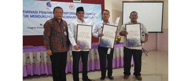
Lamongan, Geospatial News - Geospatial Information Agency (BIG) Together with Commission VII, the DPR visited various regions in Indonesia to disseminate Geospatial Information (IG). Lamongan, East Java, became the first city visited to convey the importance of the IG to support development planning.
"Geospatial information can help development planning to be more precise and accurate. In addition, the existence of territorial boundary information can minimize conflicts between villages or regions due to seizure of territory. When the boundaries of villages or regions are clear, there is potential there, for example plantations or mineral resources, there will not be a struggle, "said a member of the House of Representatives Commission VII Nasyirul Falah Amru after IG Dissemination with the theme of Utilizing IG to Support Development Planning in the Tikung District Cooperative Hall , Lamongan, Wednesday, January 16, 2019.
Meanwhile, BIG Inspector Sugeng Prijadi explained, IG could also help restore boundaries that had changed due to a disaster. This can be done by determining the coordinates.
"Example of the time of the Aceh tsunami. Previously there were boundaries. As long as there was an agreement and coordinates, we could help re-establish the boundary, even though the land had changed," Sugeng said.
IG's support in development planning, Sugeng continued, was clearly illustrated in the village boundary and spatial map. Especially after the official One Map Policy (KSP) was launched by President Jokowi in December last year, overlapping permits can be minimized.
Head of Administrative Section of the Inspectorate of BIG Roswidyatmoko added, the IG or the map is an inventory of the village's potential, delineation of land ownership boundaries and boundaries. "In addition, it also analyzes disaster vulnerability, analyzes land suitability, and monitors changes and land use change," he explained.
The District Secretary Tikung Usman, representing IG Dissemination participants, said he was enthusiastic about the event initiated by BIG and Commission VII of the DPR. He said this event was very useful to increase the IG knowledge of the community, especially residents of Tikurng Subdistrict.
"We came to know the importance of mapping village boundaries and spatial planning to accelerate development," said Usman.
For information, the event was attended by 300 participants consisting of the community and the Lamongan Regional Apparatus Organization (OPD). In addition to IG Dissemination, an exhibition was also held that featured books, atlases, maps and magazines related to IG. (YI / NIN)

